• New OpenStreetMap data as of April 18
• Minor UI bugfixes
• Updated translations
This release was brought to life by the hands and hearts of the community.
Proudly powered by Forgejo.
• New OpenStreetMap data as of January 21
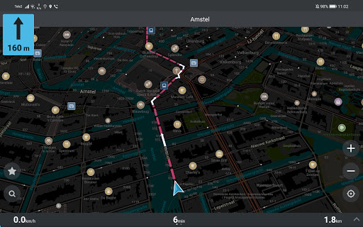
• Dispay a speed limit sign in the navigation mode
• Added Serbian (Cyrillic) and Latvian languages
• Android Auto: sort bookmarks, improved location permission request experience
• Added tower POIs
• Added a setting for Kayak.com Hotel Links and a first-use opt-out option
…more details at omaps.org/news
• New OpenStreetMap data as of November 22
• Highlight matched part of the address in search results
• Sort search history by last usage time
• Fixed start-up crashes for some older devices with Mali-T GPUs
• Other search improvements, translation updates & bug fixes
- New OpenStreetMap data as of October 17.
- More detailed (50m step) altitude isolines for Iceland, India & Morocco.
- Use a different icon for non-drinking water sources.
- Added water towers.
- Added new bookmark and search icons (tourism, information).
- Fixed a crash when opening a list of bookmarks with certain icons.
- Fixed Search on Map results prioritization bug.
• Better address search in the USA based on US Census TIGER data
• Fixed rendering of texts in Indic, Arabic, Thai, Lao, Khmer, Myanmar, Tibetan, Hangul, Hebrew scripts
• OSM data as of July 2
• Single tap selects any point on the map, long tap toggles full-screen mode
• Accidentally deleted bookmark on the map can be restored
• Fixed GPX import from WhatsApp
• Display major roads earlier on the world overview map
• Show more categories for a selected POI
…more details at omaps.org/news
• OpenStreetMap data as of June 13
• search for US zip codes and UK (GB) postcodes
• street name announcements in verbal TTS turn instructions (please enable it in settings), thanks to Will Bradley
• export bookmarks and tracks in GPX file format
• save bookmarks and tracks to a local device storage
• add, edit, and display web links to menus of restaurants, bars, and other food services
…more details at omaps.org/news
• Sort bookmarks and tracks by name
• Transitioned to the new OpenStreetMap authentication mechanism — all authenticated OSM users must re-login
• OpenStreetMap data as of April 29
• Difficult hiking trails are now brown-dotted, expert ones are black
• Dark blue lines for dedicated cycleways, mixed with white/brown dashes for shared foot/cycle paths
• Roads are now visible under semi-transparent bridges
• Fixed GPX import from Google Files app
…more details at omaps.org/news
• OpenStreetMap login works again!
• Better isolines elevation data for European countries
• OpenStreetMap data as of March 26
• Bookmark lists are sorted by modification time (recent at the top)
• Eye icons for visible/hidden bookmark lists
• Fixed crash when importing GPX, KML, KMZ from the Files app
• Bigger "View search results on the map" button
• FreeDrive mode and faster bookmarks in Android Auto
…read more details at omaps.org/news
• Fixed OpenStreetMap login
• OpenStreetMap data as of February 28
• Export all bookmarks as a single KMZ file
• Added recycling and elevation to search result descriptions
• Fixed several crashes
• "Routing options enabled" is no longer displayed when using ruler
• Included wheelchair accessibility information on place pages
• Added recycling and elevation information to search result descriptions
…read more details at omaps.org/news
• Fixed several crashes
• Android Auto fixes
• OpenStreetMap data as of February 2
• Fixed Spanish and Portuguese TTS
• Fixed KML/KMZ/GPX import from WhatsApp, Telegram, OpenTracks and other apps
• Orange colors for secondary roads
• Pressing location button now stops location detection
• Hindi support
• Restroom emoji for places with toilets
• Display parking operator
• Improved Plus Codes search, and search on the map
• Translation fixes
…read more details at omaps.org/news
• Android Auto fixes
• OpenStreetMap data as of February 2
• Fixed Spanish and Portuguese TTS
• Fixed KML/KMZ/GPX import from WhatsApp, Telegram, OpenTracks and other apps
• Orange colors for secondary roads
• Pressing location button now stops location detection
• Hindi support
• Restroom emoji for places with toilets
• Display parking operator
• Improved Plus Codes search, and search on the map
• Many map improvements
• Translation fixes
…read more details at omaps.org/news
• Android Auto public preview
• Temporarily disabled OpenStreetMap login to pass the Google Play review (see https://github.com/organicmaps/organicmaps/issues/7000)
• Fixed issue with the screen intermittently turning off
• OpenStreetMap map data as of January 5
• Improved skiing pistes and Outdoors style
• Added Max Capacity for places
• Added Azerbaijani translations
• Fixed Spanish and Portugal voice settings
…more details at omaps.org/news
Christmas & New Year gifts for you from Organic Maps community:
• Outdoors map style for hiking, cycling, and exploring the Nature
• Search for village addresses without streets in Austria, Czechia, Germany, Poland, Slovakia
• Type "skiing" to find downhill & Nordic pistes
• OpenStreetMap map data as of December 13
• Check photos, reviews, and prices for some hotels. All your bookings contribute to the development of Organic Maps!
…more details at omaps.org/news
• New OpenStreetMap data as of November 13
• The maximum zoom level is twice as deep as it was before
• Fixed import of bookmarks in KMB format
• Disabled the screen wake lock by default to improve power-saving
• Corrected the location search indication when the map is moved or zoomed
• Outdoors map style preview - read on how to activate it and about many other improvements on omaps.org/news
• New OpenStreetMap maps data as of September 20
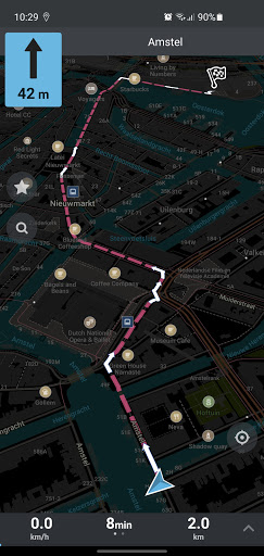
• New Ruler (aka Helicopter) routing for straight distance measurement
• Background voice and directions
• Fixed "Wait…" dialog on Android 13 with SD card
• Do not pause music when the screen is rotated
• Added/improved many icons and styles
• Improved search results relevance
• Parking entrances are searchable
• Test TTS voice in the settings
• Fixed arrow position button on Android 5&6
…more: omaps.org/news
• New OpenStreetMap data as of August 14
• Fresh Wikipedia articles
• Fixed search for addresses in Czech and Slovakia
• Added missing isolines for some regions of Argentina, Chile, Kazakhstan, Tibet, USA, Russia
• More dense isolines in some areas
• Fixed bug on Nexus 5X
• Added ferry routes to the World map
• Redesigned parking icons
• Revamped priorities system for POIs
• Faster, improved search and routing
• Many other smaller enhancements and bug fixes
…more: omaps.org/news
• Fresh OpenStreetMap data as of July 10, 2023
• Fixed several crashes
• Support altitude, OsmAnd and Garmin colors in imported GPX tracks
• Fixed pedestrian ETA for big slopes
• Better car routing
• Improved search ranking
• Share button has been moved to the Place Page
• Updated many translations
• Added new shops and event venues types
• Improved water tunnels and bridges rendering
• More detailed railways
• Added boundary=protected_area
• Better Devanagari/Marathi font
…more: omaps.org/news
• GPX import support
• New OpenStreetMap data as of June 2
• MRGS and UTM coordinates support (tap on coordinates to change)
• Improved car and bicycle routing
• Fixed bug that prevented upload of OSM edits when on battery power
• Now compass works on devices without gyroscope
• Fixed missing Wiki descriptions
• Decreased TTS (Text-To-Speech) voice speed
• Added Fish Pass
• Fixed funicular and parcel locker icons
• Corrected be, eu, en, en-GB, and uk translations
…more: omaps.org/news
• New OpenStreetMap data as of March 29
• Experimental Lane assistant
• Fix wrong location arrow position during navigation
• Fix bookmark's color chooser for Right-To-Left languages
• Properly display speed and distance in navigation mode
• Fix API to select a point on the map
• Many new shop types
• Add money transfer, bicycle charging stations, power plant
• Made park, forest, and scrub colors different
• Improved ar, be, de, hu, tr translations
…more: omaps.app/news
• New OpenStreetMap data as of February 10, including changes by the Humanitarian OpenStreetMap Team (HOT) after the earthquake in Turkey and Syria
• Filtered wrong search results in the list and on the map
• Fixed crash on opening
• Better icons for main and secondary building entrances
• Improved next-turn voice notifications for smaller distances
• Fixed Persian, Polish, and German translations
…more: omaps.app/news
• New OpenStreetMap data as of December 16, 2022
• Fixed crash in screen split mode & on screen rotation
• Supported KML 2.3 with multiple tracks from OpenTracks
• Speedup parsing and rendering of complex KML tracks
• Fine-tuned routing weights for most roads
• Fixed annoying "Enable Location" dialogs
• Enhanced maps icons for the Night Mode
• Removed duplicated names from the world map
• Updated voice navigation for Spanish, Portuguese and Norwegian
…more: omaps.app/news
• New OSM data as of November 19
• Correct bicycle's speed for routing
• Add Mastodon in "?"
• Fix some crashes
• Fix navigation menu under navbar
• Fix distance not shown on search results
• Fix some overlapping icons
• Add highway=busway and physiotherapist
• Islands and archipelagos on World Map
• Fix water/peer and waterway=dam drawing priority
• Fix leisure areas
• Add Estonian, update cs, es, nb, tr translation
• Fix RV and Catalan categories
…more: omaps.app/news
• New OSM maps data as of September 12
• Removed bottom toolbar for better UX & map visibility
• Improved OSM login page & OSM profile
• Faster, better search
• Fixed wrong elevation in some areas
• Fixed crash on startup after editing
• Bookmark lists are now sorted by recently modified time
• Fixed some translations
• Enabled Catalan TTS (Text-To-Speech)
• Added driving-, music- and language schools, archaeological_site, castles
• Improved other styles and icons
…more: omaps.app/news
• New data as of August 16
• Longer routes are calculated way faster than before
• Search should work way better and faster now, many improvements!
• Reduced size of mwm files
• Fixed issue when some found objects were not highlighted on the map
• Improved visibility of military areas and boundaries
• Show disabled parking spaces
• Added different sports icons
• Render farm yard
• Updated Arabic translations and TTS texts
• Belarusian translations of countries
…more: organicmaps.app/news
• New OSM data as of July 18
• Fixed/updated API (see omaps.app/api)
• Fixed invisible paths/trails on some Huawei devices
• Added missing shop types from top OSM tags
• Minor routing improvement
• Use min_level for 3D buildings
• Allow removing cuisines from selection in the Editor
• Fixed be, de, ru, uk translations
• Fixed FB URLs validation
• Limited bottom menu title to 3 lines
• Show only one back arrow in bookmark search
• Fixed padding of bookmark categories
…more: organicmaps.app/news
• Prettify pattern lines drawing (also fixes crash on some older devices)
• Updated Place Page style
• Icons for information=board/map
• Fixed categories search with stop words
• Show "Opens in"/"Closes in" in search results
• Made all sports searchable
• amenity=parking can be added via Editor
• Fixed place=square visibility at 16+ zoom level
• Made streams & rivers visible on the beach
• Made hedges and power lines less contrast
• Improved pt-BR, es, it, fr, eu, enabled Marathi translations
• New OSM data as of March 14, 2022
• Wikipedia articles for well-known places
• Search for organic shops and restaurants
• Material style for bottom menus and "show on map"
• Filter inaccurate network locations
• Fixed compass overlapped by layers button for RTL
• Tuned visibility of steps, footways, community_centre
• Brighter roads in dark mode
• Darker farmlands and parkings
• Added bubble_tea and water_well
• Fixed some icons
• Improved routing
• Improved ar, es, ro translations
• New OSM data as of Feb 4, 2022
• Fixed a broken place page on Android 11
• Fixed invalid routes for car&bike
• Respect "Avoid" setting for bike/walking routes
• No unlock is needed when OM is active
• Search for Water, RV Facilities and Recycling
• Added parcel pickup, excrement bags, quay, marina, caravan, dump station, mast, flag pole, funeral directors
• Improved translations, FAQ in Turkish
• Fixed HTML display in bookmark's description
…see https://organicmaps.app for a full changelog!
• Fixed KML import regression
• New OSM maps data as of 3.1.2022
• Improved search results ranking
• Fixed hundreds of capitals on the World map
• Fixed invalid inter-region routes
• Search recognizes st, rd, ct synonyms
• Duck played music when announcing directions
• Copy most of the POI info using a long tap
• Fix non-working FAQ on Android 5-6
• Consistent naming for Bookmark Lists
• Added Bulgarian, incomplete Hebrew, and Swahili translations
• Updated de, it, ro, ru, uk, tr translations
• New OSM maps data as of November 22
• Fixed routing between map regions, please test and report to us any issues!
• Type "water" or "drinking water" in search to find it around yourself
• Long tap on a POI/bookmark name/address to copy them into clipboard
• Reworked opening hours UI
• Restored "maps update is available" indicator
• Added LINE contacts to the place page
• Reduced APK size
• Updated Vulkan driver libraries
• Updated be, de, es, fi, ru, ua and zh translations
• New OSM maps data as of October 22
• Moved Help dialog on the main screen for a better new user experience
• Added x86_64 arch for Chromebooks and some old Intel Atom devices
• Added mountain saddle, mountain pass, silo, storage tank, chain barrier, swing gate
• Fixed some icons and translations
• Fixed crash for Public Routing in some cities
• Added workaround for the nasty Android 11 layout bug when toolbar was screwed up
In the previous update:
• New OSM maps data as of 02.10.2021
• Editable Facebook, Instagram, Twitter and VK links for places
• Added healthcare=laboratory type
• Copy OSM and Open Location Code coordinates links
• Fixed black screen on PowerVR Rogue G6110 chips
• Fixed icons, visibility and styles for many object types on the map
• Translation fixes
• Updated OSM maps ?️ data to 210825
• Max number of intermediate stops is increased from 3 to... try to guess :)
• Finally, maps download should work for everyone! And if not, please tell us.
• Bookmark button now shows "Save" and "Delete" instead of just "Bookmark"
• Farmlands are visible now on the map!
• ?? Brazil and ?? Portuguese translations are updated
• Fixed bug with speed camera icon
• Fixed some non-displayed texts on the map
• Fixed crashes with some deleted map types/objects
Please let us know if you still have any issues with maps downloading, or any other issues. We will fix them ASAP!
• Fixed download progress stuck at 0% and made it fractional
• Fixed metro/subway entry icons in some cities
• Added "Report a bug" button in the main menu
• Fixed invisible button in navigation panel on Android 6+
• Updated OpenStreetMap data
• Added Bulgarian and Brazil Portuguese translations
• Picnic tables!
• Fixed layout bugs, including RTL languages
• Fixed some non-working search queries
• Fixed wrong encoding in bookmark description
• Fixed import of KML/KMZ files
• Silence media volume while announcing navigation directions
• Display and edit multiple phone numbers
• Reduced apk size
• Wrong regions are not offered anymore for cross-region routing
• Improved ETA for remote roads
• Fixed FAQ
- Finally, meet the updated OSM map data!
- Fixed failing OSM login
- Fixed some map icons
- Fixed regression in preferences
- Fixed routing and search crashes
- Fixed texts in the FAQ
- Removed annoying top panel when selecting a place
- Fixed issue when new bookmark set is not assigned to the bookmark after creation
- Enabled DownloadManager notifications
- Replaced icons for adding and removing bookmarks
- Fixed "Mobile Internet" settings
Stabilization release
- Fix map downloading on some Androids
- Fix sdcard detection on some Androids
- Remove rudimentary cache directory from sdcard
- Fix kmz/kml/kmb registration